Into the Pentlands

Time to get out again…..Where?

A new hill I think so I’ve been having a look at the Pentland Hills area.

More specifically Scald Law, at 579 m (1,900 feet) the highest point over the range.

It was time to get going and do a Scottish SOTA activation before the end of 2021, I’d visited Dale Head in the Lake District in August (see previous post).

It was one of these random moments, ‘Can I go activate?’,

Scald Law

I’d overnight to get everything ready and batteries charged up. I keep a rucksack of radio equipment packed and ready to go, I always have a check just in case…..

I’d often eyed these hills as we drive along the motorway to Edinburgh so preparatory work like checking parking spots, access to the hill and GPZ track if available on to my GPS (backup option), OS maps printed off etc. Google Maps is a boon for this.

I’d noted that on one walkers report that on this road (A702) the traffic moves at high speed, it certainly was the case, just a heads up when drawing in/out from the parking areas.

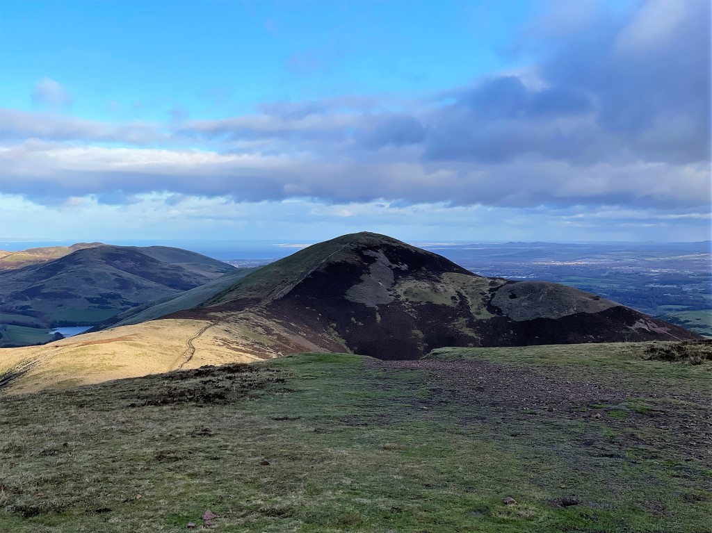
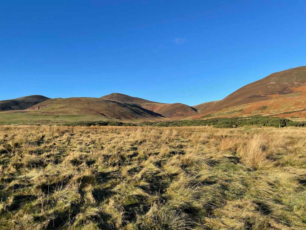
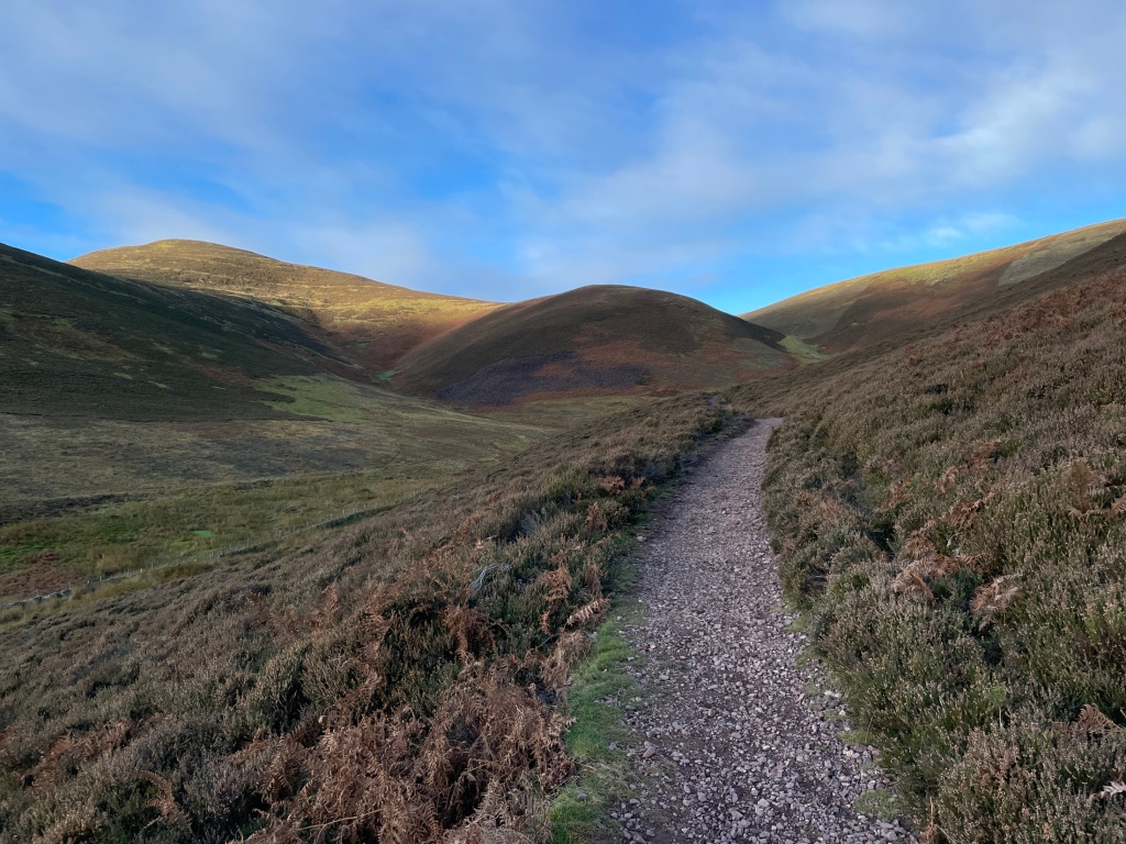
Sunday morning arrived with blue skies, sunshine and a chill in the air, a perfect day for it and I posted an online alert that I had hoped to be operating at the summit approx. 12.30 local time so off we headed, 50 mins later I was setting off through a field in glorious sunny weather. An easy first half to the walk in before a sharp ascent to where the side path for Scald Law branches off, the path was busy with walkers in both directions, just through the gate there were icy patches in sheltered parts of the path. The path is in good stead and I had worn my hiking shoes for this.

Excellent path

A steady slog then I arrived on the flat, spacious summit with its trig point, its white paint now fading away.

I’d taken just over 50 mins to reach the summit, that’ll do for me.

I chatted with others who arrived at the same time, most folk were doing the circular walk which would wait for another day.

Time to set up, as I assembled the 2m beam, I gave a call out on the 4m (70 mhz) band and a call back from a nearby station in the west part of Edinburgh, a good start. I pegged out the mast and pointed the beam west, I had a quick check and could hear the RSGB news being read, I assume it was Chirnside to the SE of me.

Looking NE

I called out on 2m (145 mhz) and steadily worked 8 stations covering an area from Howwood in the west to Edinburgh and NE into Fife, by this time the wind chill was getting to me, I got a fleece jacket out my rucksack and plodded away calling but no more takers, I thought I’d give 70cm (433mhz) a try and one call back from Dunfermilne.

Contacts locations from Scald Law

In the end, ten contacts , eight on 2m, 1 each on 4m and 70cms, excellent.

Carnethy Hill and beyond

Made the round trip worthwhile, in ’22 I think a return on a warm summer day and a longer session.

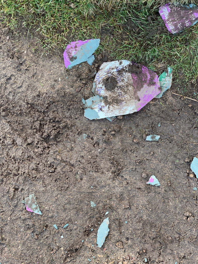
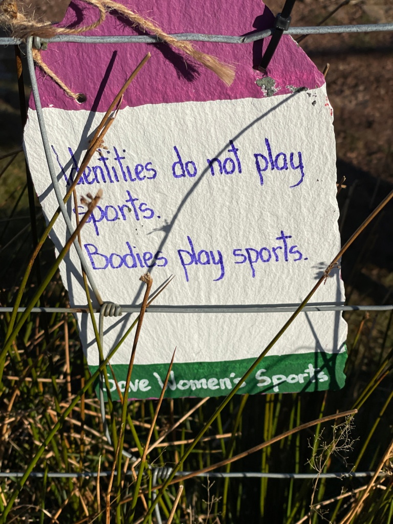
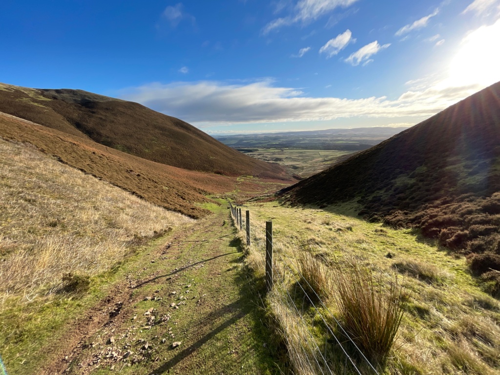
The sun had shone with the odd cloud in the sky but a steady breeze and the chill it brought, I thought time to break down and head off the hill. A quick call to Katie and soon I was heading down just enjoying the descent, I arrived at the main path and noticed the decorated slate I’d seen on the way up wasn’t there, I opened the gate and there it lay in pieces on the path, see Gallery below.

Why? in such a spot too.

Once back onto the lower access path, I could see the Chevy sitting waiting on me.

Longlea reservoir

A warm, heated car and a hour until back home.

Heading back

I found lots of information on the walks available in this area, just google Pentland Hills.

Scald Law,

Wikipedia has some info on the naming of HERE

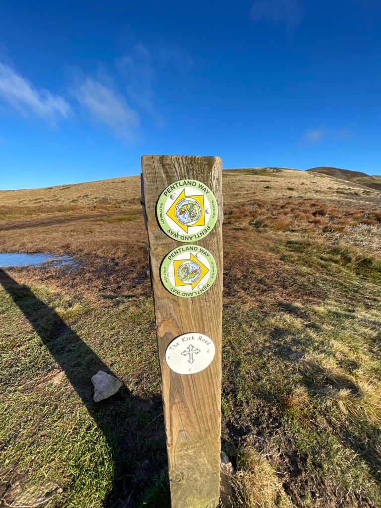
The Kirk Road as mentioned on the waymarked image post see HERE

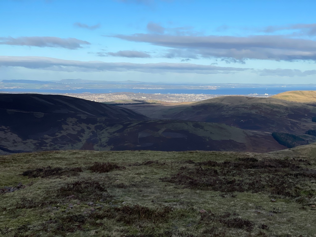
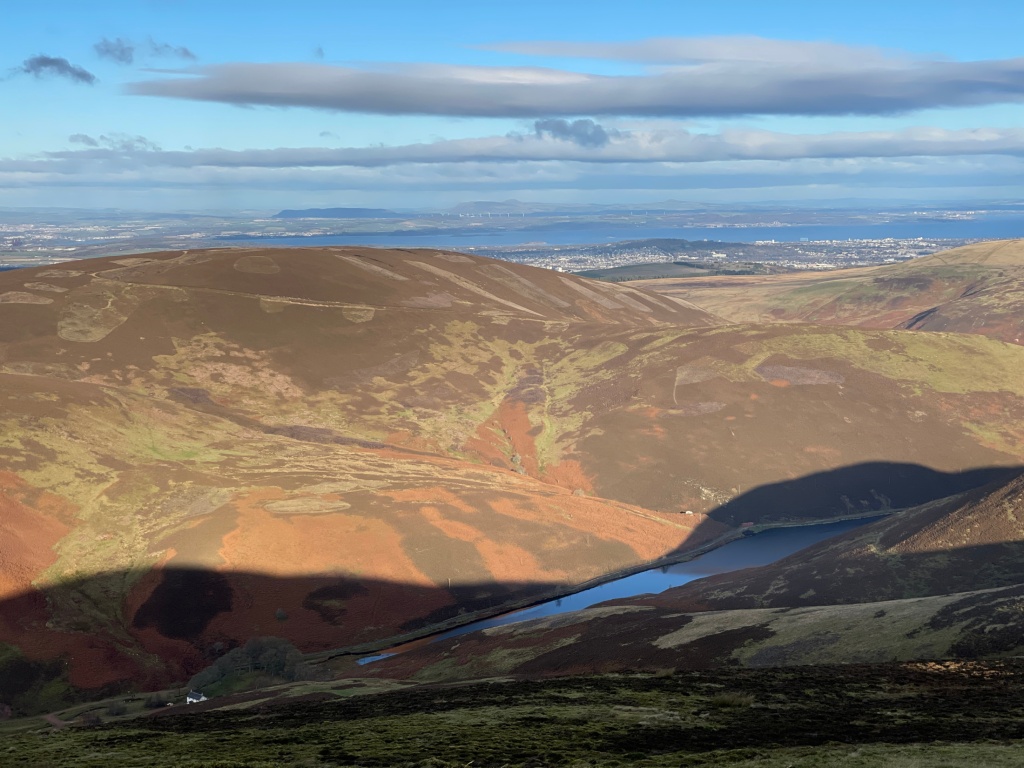
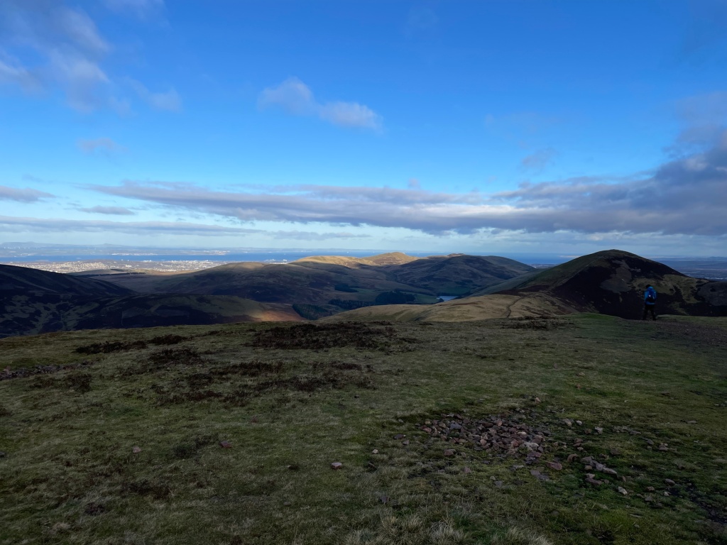
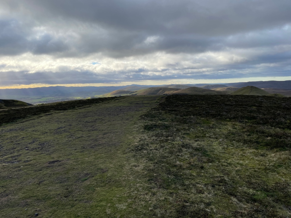
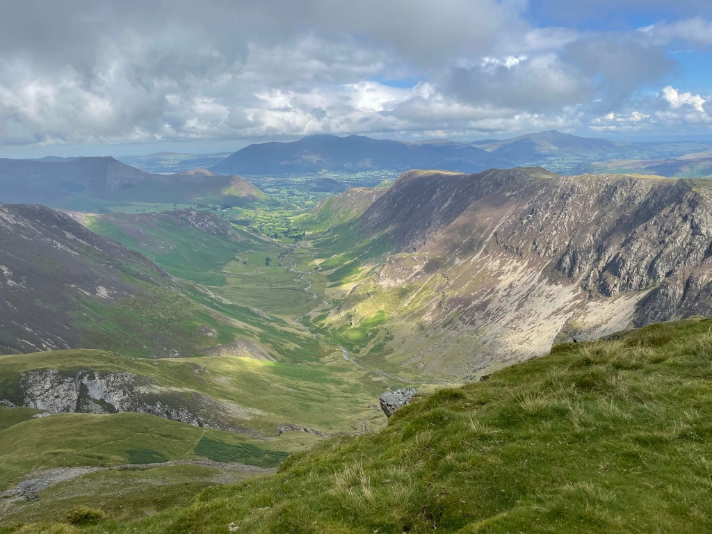
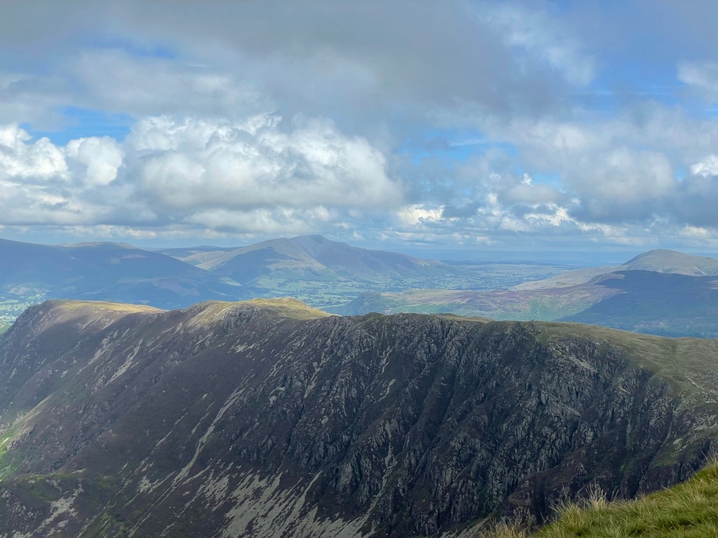
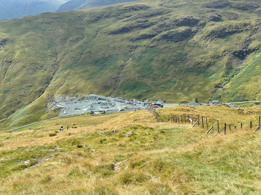
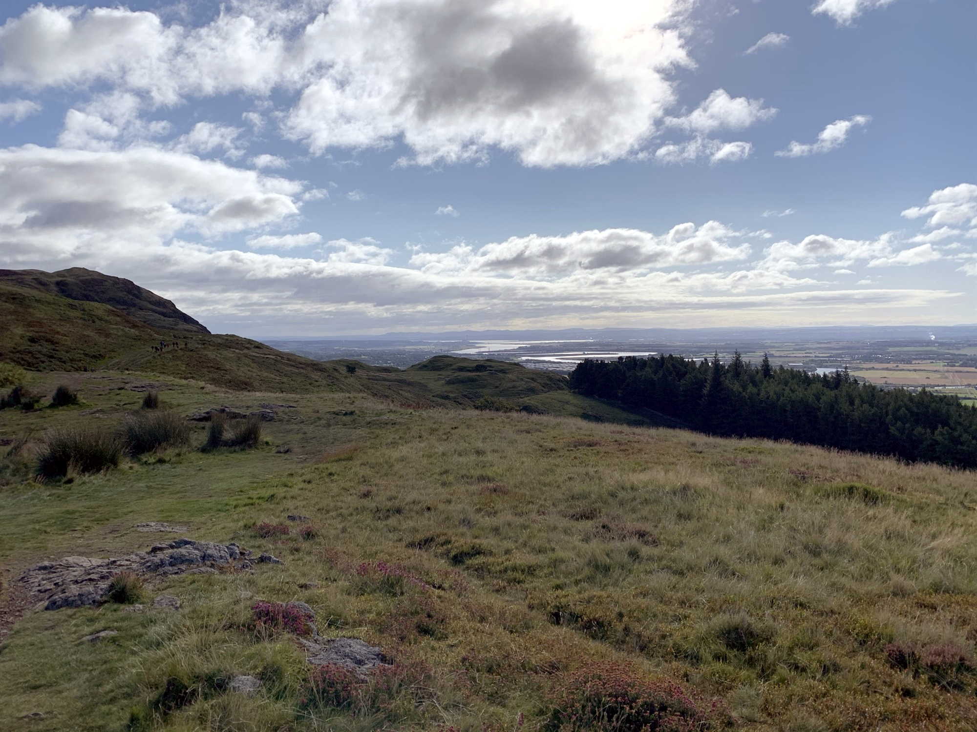
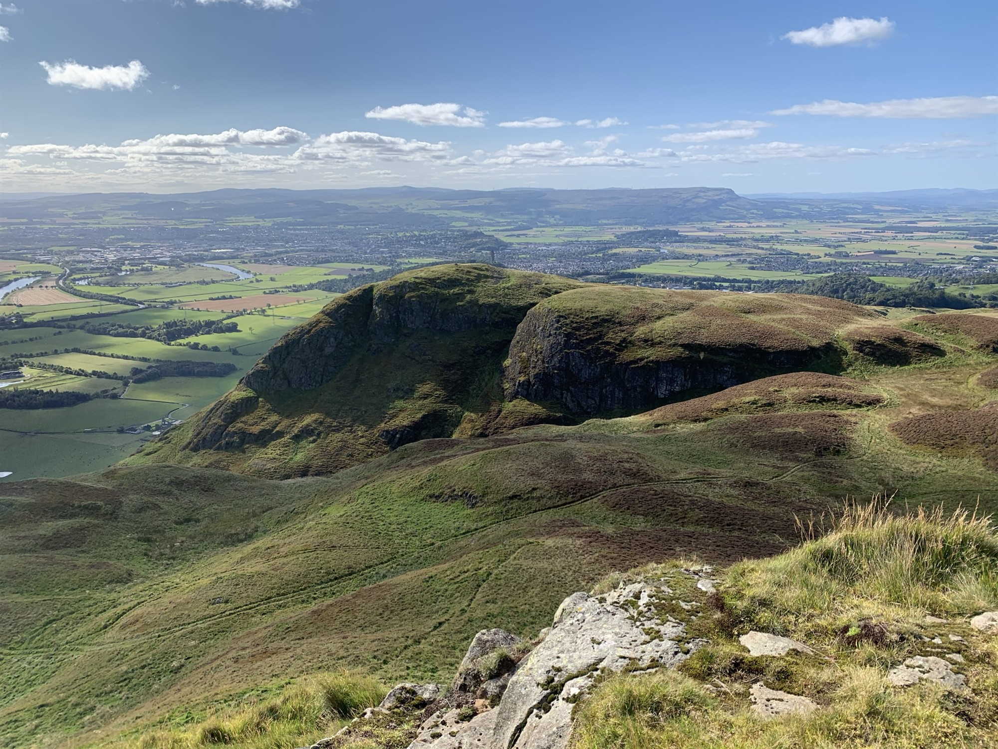
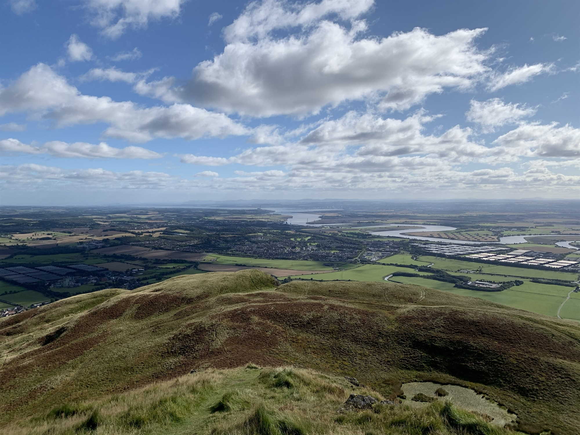
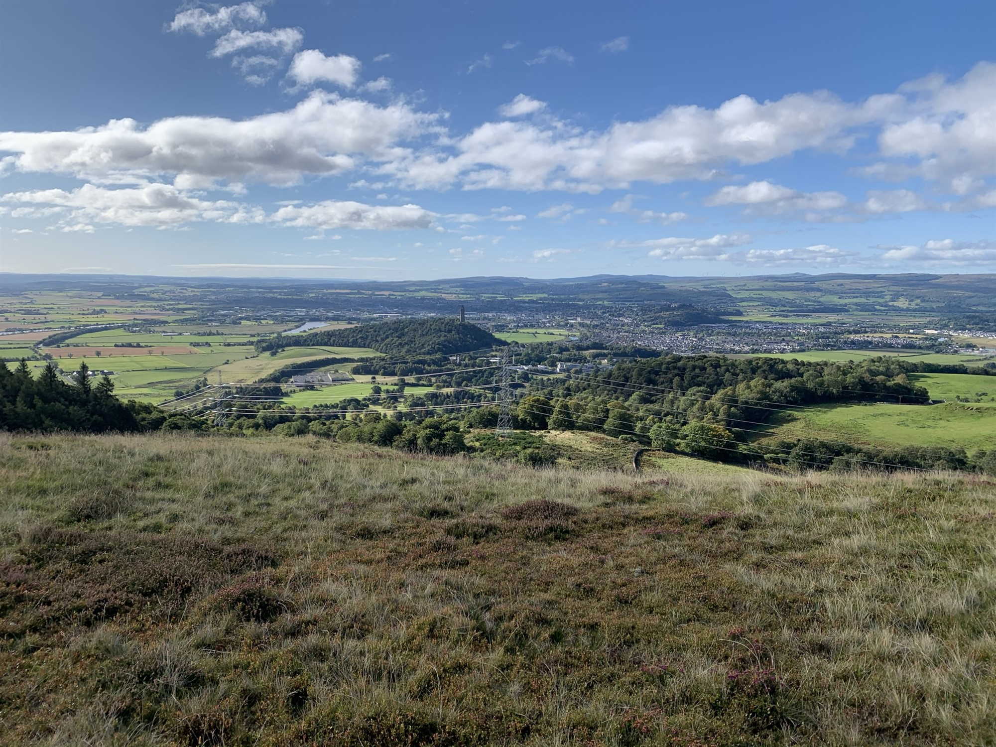
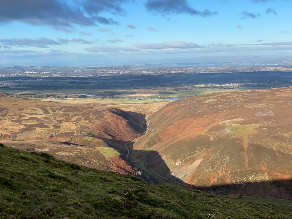
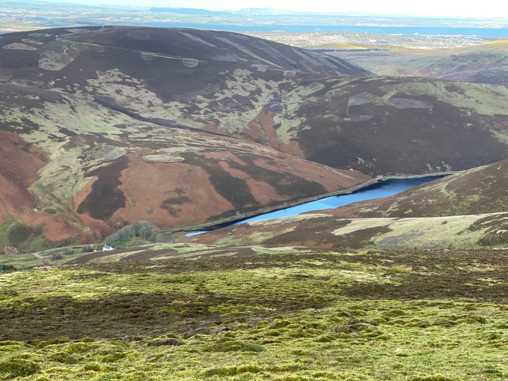
Impressive views from the summit

Dale Head

Following the relaxation of travel restrictions, I thought of a flying visit across the border to the Lake District, it had been four years since our last visit, late 2018 and 2019 were taken mostly looking for and preparing to move eastwards to our new home, 2020 and the first half of 2021 were the Coronavirus pandemic.

I’d planned a couple of new fells to hike up and do some radio SOTA work but ‘staycations’ have made a normally busy Lakes into an exceptionally busy Lakes.

We had decided on a day visit, we are now an hour less travelling so we decided to watch the weather forecast but I had to get all my radios charged and ready to go. Everything was still in the rucksack from my last attempt at a Fife hill so emptied everything out then repacked it all back.

I’d been waiting until I got to the border before deciding if I was heading up Dale Head, the north-western Fells had patchy clouds showing so after a stop for some scran, it was Borrowdale and Honister Pass bound.

I haven’t done any serious walking in almost a year so I expected a bit of haul up to the summit but I slowly made my way up a familiar route before summiting and enjoying my favourite Lake District view, it never fails to exhilarate.

I’ve done a few blog posts on this hill so HERE HERE HERE are a few, I didn’t bother with many photos as you can see more views in the previous posts.

The ascent had been busy with walkers, I arrived to an empty summit so a couple of photos then I got ready to activate the hill, SOTA uses the Marilyn hill system and Dale Head is worth 6 points BUT only if I manage to contact another 4 amateur radio stations.

I contacted 9 stations to the east and south of me, one was on the summit of Tal-Y-Fan, Wales’s latest mountain which I’d activated in pouring rain almost 8 years ago.

I set up the antenna and portable mast and got ready, I’d heard the aforementioned station in North Wales but I called on 2m FM and my first contact, a mobile station to the east on the M6 motorway, I then located and spoke with Dave on Tal-Y-Fan, other contacts were made in Lancaster (2), Morecombe (1), Wirral (1), Penrith (2) and Caernarfon.

It was good to talk with regular chasers Sue, Brian, Geoff and John, I threatened them I was be back down soon, hopefully on another fell, I must pour over the map.

The summit by this time was a constant stream of walkers and I fielded the usual ‘what are you doing?’ and the now ‘Calling Mars(or other planet)?’ comment which I don’t mind, it doesn’t take long to explain what I was doing.

Once again phone coverage was patchy so a quick text and call to Katie and I packed everything away and it was time to do the bit I’m beginning to dislike, the descent, I don’t do descents very well but I could see her in the National Trust car park,. A wave of acknowledgement and just under four hours later I was back at the car, glad to get my walking shoes off.

There has been quite a lot of mining and slate workings in the area, the old miners and slate workers must have been a hardy lot. From the summit the 360 degree views take in to the north, Grasmoor, Grisedale Pike, Skiddaw and to its east, Blencathra. The south and west, nearby Pillar, Great Gable, Hindscarth and Robinson.

There is an old slate mine at the top of Honister Pass across from the start point with tours etc, see HERE

Some Lakes mining info HERE

Another visit to a hill that is in my top 5.

Wonder when I’ll be back?

Perhaps my 70th birthday hill, eh, 25 months to go.

Dale Head, Wikipedia entry HERE

It’s been ages…..

Wow, I didn’t realise how long since my Dumyat post..

We are still slowly coming out of lockdown and hopefully moving back to some sort of normality.

I did ‘activate’ Cairnpapple Hill last Oct (2020) on a whim, Mrs M was heading over to Livingston so I asked to be dropped and picked up on her return. Cairnpapple is the easiest ‘Marliyn’ to access in Scotland. It took 5 or was it 10 mins to the summit, I did avoid the scheduled monument just to the N and setup nearby.

It was midweek so it was surprisingly a few stations replied to my calls on VHF.

The image below will show their locations (I know the mountain symbol LOL)

I’ll take that midweek, I’d worked seven stations on 145 MHZ and one on 70 Mhz….

That was to be my final SOTA activation in 2020 BUT the following Sunday it was off to the (Kingdom of) Fife to near Ballingry and the ascent of 365m Benarty Hill, I’d started off up through dense woodland and when I reached open ground, I stopped at a rough ‘stony’ area to let others pass down, I moved then felt (and heard) something go ‘pop’ in my left calf.. not good so on the phone and call Katie to come back and pick me up, I took my time descending, oh well, hopefully I’ll return soon.

Further serious Covid-19 lockdowns took place so the bike was a good way to escape the house, I still played radio on the high spots I’ve found whilst out and about. Handhelds in the handlebar bag for a call with the occasional chat, a good excuse to stop after long slogs uphill.

I tend to be impulsive when out on the bike, if I see something I’ll just detour to see it, one morning as I was heading out with no route in my head, I got a text about a giant iron Roman head on nearby Croy Hill, I had seen it high above the canal path previously but this time I headed off the canal path and made my way using a very steep rough path and finished by pedalling my way to the top..

A week later a little further up that road, I saw an easier path in, oops.

Impressive with stone markers with other information at its side.

A good viewpoint and I got local info about a rough path which would drop me down to Auchenstarry Marina back on the Forth & Clyde Canal, I then headed west to check out another replica marker stone in nearby Twechar village. One more to find so it was off to near Lambhill Stables on the outskirts of Glasgow. I keep threatening to explore the many fort sites along the Antonine Wall, so more to follow.

I have a few go-to high spots where I have a call out on a VHF handheld radio, one on the road east from Carronbridge has flung up some interesting contacts, I’ve highlighted those (see below) who have been on high spots operating, I have other regulars I chat with in the nearby built up areas.

There are other spots I stop to call at, this one has an excellent take-off east and south west.

I give calls out on 2m(145 mhz) and 70cms (433 mhz) but higher hills to west restrict me in that direction but I’ve another stopping point at the Tak me Doon car park which dominates to the south and west. It’s a well known climb but I access it from the north, a much easier (?), still a few testing sections but a welcome stop.

Further areas include SE of Cumbernauld, west of Shieldhill amongst others.

I’ve my fishing permit for the Forth & Clyde Canal but haven’t organised myself yet, I think I’ll wait until late autumn before I start but I’ll stop occasionally on the bank and chat with anglers just to find out info on best areas to fish, I’m interested in small fish, the canal holds good stocks of pike and tench but for travelling light on the bike, I’ll stick to roach and perch. Wonder how Mrs Mhor will take to me keeping the odd tub of maggots about LOL.

I did spot this method of fishing which could appeal

I could pass time this way…

On the same day I headed out towards the Falkirk Wheel and up over to join the Union Canal, the tunnel at Roughmute had been closed and they have installed new lighting, the camera enhances the light and it changed colour every so often, one snap below

Disco lights

On my way there, I came across this

Someone’s upset

I assume it is directed toward walkers rather than cyclists on what is a busy section of towpath, there are other similar ‘instructions’ spray painted further along the path, someone is upset.

Whilst I am at it, I’ve included my ‘wheel’ of 2020 rides.

3,000 miles plus I was happy with it considering circumstances.

My thanks to Veloviewer.

© Veloviewer

I’m well down on last year but am in four figures now, hopefully rack up the miles in the last half of ’21.

Have taken to doing some veg growing in tubs, I’ve potatoes, onions in bags, amazing growth in the spuds but I don’t think I’ll harvest much. Tomato plants, both cherry and regular plants, I’ve trusses showing on every plant, interesting and have possibly found the variety I’ll grow next year, I had sown some seeds mid April which was I’d say far too late but the spring onions were a success along with peas which have been picked weekly for the pods.

We have strawberry plants which aren’t mine but still producing very juicy medium berries.

I haven’t grown anything in almost 30 years so I’ll be better organised next year and any lessons learned will be put into practice. I’m still hoping for some spuds but we will see.

Back soon…..

SOTA….Dumyat

Dum-eye-at..

I pronounced it it wrong last time I paid a visit..

I’m lucky it doesn’t use its Scots Gaelic name..it should though, I think, Dumyat is Dun Mhead (Fort of the Maeatae)… click on the link HERE.

Forth Valley from the ascent

Forth Valley from the ascent

I did the ascent ‘directissmo’ from Blairlogie in ’19 but this time, I took the tourist route from above Bridge of Allan on the Sheriffmuir road would suffice, and after one mile ascent of rough narrow single track road, not for the faint hearted driver. I know how broken the road surface is as I descended it on a return from Sheriffmuir on my bike earlier this year. We arrived.

Looking W from the summit

Looking W from the summit

A sunny, brisk autumn day and the hill was busy going by the car parking areas already being full.

I had enjoyed the Meikle Bin trip the previous Saturday so this time I decided to bring the Yaesu FT 817 out of retirement. I was more prepared this outing, the rucksack and equipment checked over just before leaving, in case…..

Looking along the valley

Looking along the valley

I had ‘declared’ for lunchtime so I headed up the well maintained path which was busy with people heading in all directions. 55 mins later, I was at the summit, the obligatory visit to the trig point before choosing a spot out of a chill north breeze, I could see extensive views of the Forth Valley stretching out to the three Forth bridges. Stirling Castle and the Wallace Monument were nearby.

I grabbed a bite to eat first, then I set up the mast and the beam, pegged it out this time round, pointed it southwards and listened.

Summit and beacon

Summit and beacon

Rob YTS was somewhere to the N of me on Beinn an-t Sidhein just NW of Loch Lubnaig so first contact was in the log, I had a listen and could hear a station 5ZX along with FTU on the summit of Scafell Pike in the Lake District, a few calls and I got through, it could have been a losing battle as the highest peak in England could be inundated with folk calling them. Details were exchanged and it was off to call local.

First to respond was Christine YMM and Ken AXY in Edinburgh, a station in nearby Clackmannan area IIO and I had a quick chat before I spoke with David HWZ this side of Glasgow, no enhanced propagation this week.

Stirling

Stirling

Regular chaser Steve XPZ called in from Greenock, Robert GUF from Biggar with Paddy JOX in Knightwood next.

I decided to give 2m SSB a try and had two contacts, Rab RWJ in Motherwell and PKL in Edinburgh, I should have changed antenna polarisation but hey ho!.

A bite to eat and a last call. speaking with locals Jim VGR and Jonathon OKG just literally at the bottom of the hill before a last call and longer chat with another local, Hughie UYE.

15 contacts, happy with that from a hill of 418m ASL, I knew another station had declared for Benvane to the far west so I waited in the sunshine but nothing heard, it was time to head home, after an organised pack of the bag and I called home and arranged that I’d just walk down into main part of Bridge of Allan to avoid any possible chaos at the car parking areas. It was chaos, cars parked everywhere..

90 mins later I was waiting on Katie.

I needed coffee.

Easy to activate, it’s the logging afterwards, one in my so called paper log done on the computer Libre Office, an electronic logging program (Log4OM v2) and an upload to the SOTA database.

Dumyat contacts

Dumyat contacts

One point added to my SOTA activation total…

The SOTA system of scoring uses the ‘Marilyn hill tables’ and points are from 1, 2, 4, 6, 8 and 10 depending on height.

For example Dumyat at 418m is 1, Meikle Bin at 570m is 2, The Cobbler(Ben Arthur) is 4 pts, Ben Lomond at 974m is 6, Cruach Ardrain at 1046m is 8 pts and finally Ben Nevis at 1344m is 10..

These are just examples of some better known hills.

Some tough one pointers out there in Scotland, this one was easy.

Next hill was to be easier.