(Jan) Radio Days and…

Time again for Bawb’s monthly warblings on his radio and other related activities plus a wee update from Lance on his saddle-sore activities.

January was a tough month weather wise but there were some keen souls out activating but I have one activation to report on.

Tinto…

A visit to Tinto Hill in Lanarkshire was taken on the second Saturday of the month, the original targets of Glen Douglas hills Tullich and Beinn Bhreac were in doubt as the forecasted weather would not have suited. It was meant to be low cloud and frosty conditions, Roddy IOB had mentioned Tinto during the holiday period and we decided to head there on the Saturday, Tinto has a well-defined path nay ‘road’ at most points which means easy access in cloudy or misty conditions.

Tinto summit cairn

Tinto summit cairn

STS (summit to summit) contacts were aplenty, six in all, NW to Robin PKT on Beinn nam Beathrach in the Morvern area also Iain WJZ on both summits of Buachaille Etive Beag in Glencoe. I also worked Jack COX on Uamh Bheag and Colwyn YCJ just to the N of him on Stuc a’Chroin and finally just to NE, Adrain DHY on Meikle Say Law. Excellent day plus a WOTA contact in Richard JTD on Lank Rigg. Interesting contact on 70cm was Derek MIX out walking in the Loweswater Fell area, a surprising but good contact.

My blog report is HERE

Roddy 2MØIOB’s report is HERE

Chasing…

I have covered in the short Tinto report the ‘chases’ from that day but first name in the chasing log for 2013 was Bob AWV who turned up on Meikle Bin ironically at the same time as Iain WJZ so a double call that day. Later that day I worked Robin PKT on the summit of Meall Bhuide to the NE of Loch Earn. A good day to start the years activity. Next in the log was Craig PHT from Duncolm in the Old Kilpatrick Hills.

That was all the activity for me in Jan as I missed time at weekends to chase due to the uncertain weather as I had worked the last two weekends of the month. Two good overtime shifts not to miss. Got to keep the roads and pavements ‘open’. Hopefully back to normal now…….

Waiting at home

Waiting at home

HF…

Busy month almost entirely on JT65 with once again, a sortie on to the JT9 band area. No new DXCC to report but contacts across the pond and to the E as well as the regular Euro contacts. Time to head back to PSK I think….

I did however set myself to try another ‘older’ I suppose data mode but more on that once I give it a serious try. I did think of trying FreeDV, a new SSB to data mode but I will have to ‘install’ another sound-card or perhaps, one of those sound-card ‘dongle’ thingies….

Lance’s Bit…

Hi all ! the wizard of the saddle’s first wee report.

Yes, the rear area still is hurting after putting a few miles in and as Bawb has now fitted the gel seat, life is slightly just slightly easier. I’m still getting the hang of this cycling lark and I hope to go further afield as the sunny summer evenings start.

Luckily there is a cycle track (NCR 75) not too far from home, it heads westwards towards Greenock and eastwards to the Johnstone area and beyond. I have found that in exposed sections that if it’s breezy yer reporter is not very aerodynamic.

It’ll be used well by myself as the surface is more safe than the main and local back roads which happen to be in terrible condition in places. I’would have to carry a rope to pull myself out of some of the pot holes I have spotted lately.

Others…

I mentioned Beinn Bhreac (Gaelic – the speckled hill or mountain) the Marilyn in Glen Douglas earlier and was surprised to find another ten Marilyns of the same name plus countless others….a contender for most common hill name in Scotland? 60 in all ?

No precipitation forecast

No precipitation forecast

Just as an aside, I have done some ‘research’ into Scottish hill names and came across an interesting story about Lochnagar. Its original name was Beinn Ciochan which literally translates as ‘mountain of breasts (or nipples)’ and allegedly Queen Victoria took a liking to the said hill and the hill got renamed……Victorian prudery ? allegedly..and as I looked further into Gaelic equivalents, I would have to label the blog ‘mature’…they had quite a vivid imagination in the past.

If you look at the image of a screen dump from my phone this last week, you will see that 0% of precipitation is forecast for SEVEN days, four or five weeks ago you would thought we would be ‘drowning’ with the constant deluge of rain…then this.

I’m threatening myself to get more done on the SDR dongle front and as I have all the parts to hand so maybe now more can be done on this front although eventually I will have to fit it in an aluminium box but the box it was built around is US based and the usual $ to £ plus if ordered here. I’m still searching for an equivalent.

Once again, thanks go to Wikipedia, Peakbagger and IWeather for the WX screen dump.
On Tintock Tap, There Stands a Mhor

With apologies to this old Scots rhyme..

On Tintock Tap, there is a mist

On Tintock Tap, there is a kist

And in that kist, there is a cup

And in that cup, there is a drap

Tak’ up that cup, and drink that drap, that’s in yon kist, on Tintock Tap !

Time to tell the story of the day of  how Mhor and Roddy took to Tintock Tap…

Tinto Sign

Tinto Sign

This had been planned around the festive holiday period but initially Tinto was not the target hill(s) but was then pencilled in for the last weekend but a careful  watch on the weather made a switch to Tinto but strong winds and with the possibility of rain showers knocked it on the head.

We decided on Tinto as the next hill and with texts and calls back and forth over Thursday and Friday with a decision to go on early Saturday morning.

The morning dawned misty with cloud levels on the Luss hills about 1400 ft but we knew Tinto had a path in case of low cloud or mist.

We headed through Glasgow then south along the M74 and as we do or should I say me ! I rabbited on that much we missed the turning so a diversion back towards Thankerton and the Tinto car park. We arrived slightly later than planned  but all gear looked out and off I headed, I get sent ahead for two options, first because I’m slow and I can scout out any problem, I think the former is the correct one. There was cloud covering what we perceived was the summit area. The forecast was for sunshine at midday with a wind chill in the region of minus 9c.

I headed through some soggy bits which with a light overnight frost had made the going easier but after I passed the Iron Age fort the going got steeper but much drier. The Iron Age fort stands proud but it is better to view this from a higher height but you will recognise this as you see the ditch defences as you pass.

Looking down the hill

Looking down the hill

I headed steadily up occasionally stopping to look back and take in the views, Endomondo told me that the first mile had passed and not long after this I was joined by Roddy at the top of the first steep rise that cuts along the side of Totherin Hill, the path here is broken rock and is relatively easy-going but steadily rising and passing the rather funnily named ‘Maurice’s Cleuch’ on the right.( Cleuch means ‘narrow glen or valley’)

I could hear the occasional  ‘chut!chut!chut!chuttt’ of a grouse… and the hillside towards Scaut Hill is cut in patches for grouse management, click  HERE for more info.

We could see the summit as we headed over the second steep rise and it was then on to the last climb which eventually we were to summit.

First stop was a suitable spot next to a very handy fence line, I dropped the rukkie and headed to ‘bag’ the trig point. A short walk away is the Bronze Age cairn to which I added the stone I had carried from the ascent as I hoped this would be the catalyst for a good day. Photos were taken whilst the sun shone but there was a hazy horizon of rolling hills not the usual jagged outlines of northern hills. No panorama taken this time, an excuse to return.

Time to get the radio set up, I bungeed the mast to a fence post and called and called on 4m. Nothing ! I heard Roddy working Iain WJZ who was on Buachaille Etive Beag northern peak the impressively named Stob Coire Raineach and I was to later catch Iain on its other Munro top Stob Dubh. The day’s weather had brought more than a few GM stations out so next in the log was Colwyn YCJ on Stuc a’Chroin, his second summit of the day and to the immediate south of YCJ  next was Jack COX on the summit of Uamh Bheag .

The summit cairn

The summit cairn

I tried 4m FM again and got called by Duncan AHL who lives the other side of the river from me. I had a quick talk with Duncan before calling again but to no avail. I dismantled the JPole and up I put the beam which I had assembled between calls on 4m.

70cm FM was my next band of choice and after a few calls I got a pleasant surprise being called back by Derek MIX who was out walking nearby the shores of Loweswater in the Lake District. I had last spoken with Derek from the summit of Robinson the previous September. A good contact. This followed by a chat with Billy VYU who was in nearby Carluke. This was all I raised on 70cm but I had activated the hill for myself.

Meanwhile the wind chill was starting to take effect and much moving of hands and upper body to stay warm, my feet ? no problem as I had recently acquired a pair of mid weight boots which are designed for cold conditions. Toasty toes..

Roddy IOB at summit cairn

Roddy IOB at summit cairn

Further to the NE, Adrian DHY was worked on the summit of Meikle Say Law in the Lammermuir hills whilst I then swung the beam south when I heard Richard JTD on WOTA summit Lank Rigg to the south-east of Whitehaven. I did briefly hear a well kent Lancaster station talking to Richard. Another WOTA point for the log. I had said that I was going back up to S20 the calling frequency and as a result I worked two stations in the Annan area, Mark MPB and this time at his home town Geoff WHA.

Whilst scanning the 2m band I heard Jack COX talking to Robin PKT who was on the summit of Beinn nam Beathrach just the south of Loch Sunart in the Morvern area. With some fiddling about, changing this and that we finally got the summit to summit with Robin, a good contact of about 170 kms away with some bigger hills between. This was the last STS of the day, a total of  six STSs, one STS to a WOTA fell.

The last calls in the log were Liz EPW and Colin XSD based in the Cumbrian village of Frizington.

A good end to a chilly day on Tinto. It was time to descend as the ground was firming under our feet.

I packed everything back in the rukkie in its usual haphazard way and off we set down the path and after only 50 mins Roddy was brewing the hot water for a cuppa. An excellent hot ending to Tinto.

The car park is in great condition and seeing the amount of folk and dogs who trekked to the top in the time we were there it certainly paid off extending and upgrading it.

Looking south

Looking south

Heading home we took the right road this time and a cracking view of the setting sun having the sky on fire to the SW of us had Roddy stopping to photograph this although rather strangely he attracted an entire field of ewes who came trotting  nay running towards him and looked whimsically at him when he returned to the Landy and drove away. Perhaps his  ‘Ewe de Cologne’ ?

A first activation of 2013, a lot earlier than the previous year and hopefully more activity for me on the summits in ’13. A few pointers  taken out of this activation and will be put into practice next hill.

A big thanks to Roddy 2MØIOB for the tour and waiting on me again !

Thanks again to Wikipedia, Peakbagger and any other websites I have linked to.

To embiggen any image just right-click and they should open in a separate window.

Typical in my preparing this I managed to make 4 errors…yeah 4 but thanks to my eagle eyed ‘friends?’, Neil and Roddy.

Tinto Facts..

Tinto means ‘Fire (or Fiery) hill’ from the Gaelic, there are other meanings due to the colour of red stone present.

it is 707m or 711m, the lesser is ground level and the higher is on top of the Bronze Age burial cairn.

Hill classification : Marilyn, Graham, Donald

Geohack Info HERE

Yomping Through The Heather…Creuch Hill

I’d noticed this last week that someone had looked at my earlier Creuch Hill blog post for route and hill information so I made a mental note, a trip on the first date available as it had been almost two years I last made the trip to this summit. Now I remember why !

The previous day, Saturday would have been ideal as more than a few of the regulars were out multiple activating but I had committed to start replacing our back garden fence.

I had hoped the weather forecast would stay true and like the last trip out to Corlic, the sun shone with only the occasional cloud in the sky, I had charged everything up as usual at the end of the week as Robin PKT had been activating throughout the week. Ready to go !

This hill requires a drive to Greenock where you head out what is locally known as the ‘Old Largs Road’ heading past the Whinhill Golf Course on your left before heading into open moorland on a single track road heading along Loch Thom before coming to a junction, Greenock Cut Centre (worth a visit) is the road to your right but you now carry straight on into a narrower single track but with plenty passing places and as you head into North Ayrshire at the oddly named Rottenburn Bridge, in the distance you will soon see pylons crossing the road, the parking place is soon after this on your left at NS 251678. Time to make sure you have all your equipment and head off the obvious track to the first gate. Keeping on the track you now come to the burn where you gingerly cross a patched up footbridge and now climb the gate into open but rough country.

Goat Fell and the Brisbane Glen

Goat Fell and the Brisbane Glen

There is an obvious point to aim at but this is where the old shielings are whilst the summit is to the north of these. There is an old track which disappears in places for part of the route but looks as it hasn’t been used in many a year as nature is reclaiming it, on my last visit there was a faint quad bike track but nothing this time, the track disappears not long before the first pylon, I now headed up working my way through heathery tufts, marshy areas and almost hidden drainage ditches, believe me it is that rough.

Not long after passing under the pylons, I headed eastwards to see if I could see the remains of a branch of the old Grouse Railway which ends near old grouse butts at the south east base of this hill but I saw no evidence. I now headed straight upwards skirting the old shielings ( these are not on the OS map) and head to the obvious wrecked trig. The trig point was demolished in 1987 according to T:UK. Sadly demolished on the spot and no debris removed.

It had taken me approx 45 mins to cover the 1.7 ml.

I set up my 2m handie to listen for any SOTA activity whilst I set up the station, first I set up the mast with the 4m JPole and called CQ but nothing, I had a scran break then tried again and worked a station in the Dumbarton area. I tried again but nothing although I did hear a couple of Irish stations.

It was time to put up the assembled 2m yagi and today it was just pointed north as the declared activators were as if they were in a direct line, first I worked Craig ANL who popped up on Ben Bowie which I could see line of sight. A quick word and the first point was in the bag.

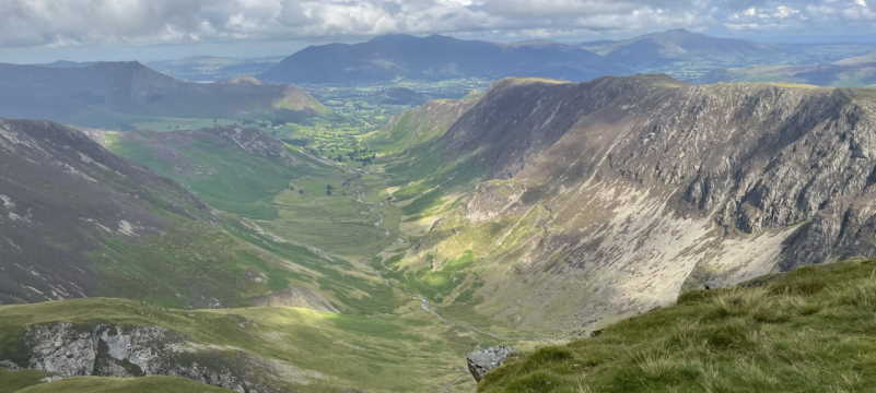
The views all round were fantastic due to the excellent air clarity, Goat Fell and the north end of Arran, Cumbraes and Bute to the south-west whilst the vista from the Cowal Hills to the Old Kilpatrick Hills was stunning, Glasgow land beyond spread out to the east and as you looked south-east into the Lanarkshire hills and finally due south, the North Ayshire hills and its only Marilyn, the Hill of Stake. Superb views which my photos and panorama will do no justice, I think a return to here will be earlier than later, I last visited the hill in 2009, deep in the post list there is an earlier blog post.

Looking North

Looking North

I was monitoring .500 when I heard Iain WJZ calling, we headed down to S18 and made contact, Iain was in what I call my ‘Etive Triangle’, from Creise to the big Buachaille and in a triangle south, I seem to struggle although I did catch Iain on Ben Starav the previous day, Iain today was on Stob Dubh and had activated the hill for its first time, unusual in that area. I left Iain to go and wait on Graeme GIL and Neil NCM but I next heard Robin PKT who was out on Stob Ghabhar in the Black Mount area to the east of Glencoe. Excellent signal both ways and I had a quick chat with Robin before heading to check .500 again. I was as usual chatting on occasion with Roddy 2MØIOB who was walking around the circular Greenock Cut walk from Cornalees, the other stations worked today were Jack COX from his home qth and Brian HMZ in the Paisley area. I then heard Graeme 2MØGIL calling and spoke to Graeme for a time then he was off to look for the other summit stations.

I eventually got talking to Neil on the slopes of Ben Vorlich (The Lomondside one!) before another quick word with Roddy before I broke down the station. I had entertained heading over the hills back home but knowing I had more than a few miles of heathery stuff and bogs to tramp through I took the lazy option and got picked up at my drop off place, a sensible idea I think. Cruach is 5 mile as the crow flies to my home but the route I would take would add to that, the lack of any paths helped make my mind up.

I headed down the hill trying the direct route but this ended with me almost in a massive boggy area so a double back and head down through yes, more heather. I was nearing the track when I saw Katie drawing in the parking area which has plenty of room for when of you think of visiting.

Cruech Hill start

Cruech Hill start

A good hill with a great VHF take off for 270 deg but take off south is blocked by the higher North Ayrshire hills.  On a good sunny day, it is worth the 3.5 mile round trip just for the views alone. I’ve been on this hill a few times over the years and never have met or seen anyone, I can see why. On the short muddy track through both gates there were no footprints.

A good day ended with a quick word from home with Neil NCM heading back home and not much later, Craig ANL had the temerity to visit my fiefdom Corlic, I heard him call and whilst we were on Roddy 2MØIOB popped in.

Congratulations go to Iain WJZ who this week achieved his ‘Shack Sloth’, I presume there will be plenty of STS(summit to summit) chases in there, well done on slothdom.

Feel free to click on the images to see them in a fuller size

Hill info…

Creuch Hill  441m ( 1447 ft) ASL

‘Creuch’ is an old Celtic word meaning ‘mud or loam’

Drop is 87m

The highest point in Inbhir Chluaidh (Inverclyde)

Trig Point – TP 2584 more info <HERE>

possibly used as a fort at one point <HERE>

Route <HERE>

My thanks as usual goes to Wikipedia, T:UK, SOTA etc for all linked to material.

Map <HERE>

(April) Radio Days….2011

VHF….

Working 2m from home, still monitoring 4m FM and 70cm but not much activity.

SOTA….

One activation this month, a visit to King’s Seat in the Sidlaw Hills to the W of Dundee.

Chasing..

First in log was two summit to summit contacts from the top of King’s Seat, Iain WJZ was first, Ian was on the summit of Corserine in the Galloway Hills, a cracking STS across country and Barry TOE was to the N on the summit of Mealna Letter for the next STS, a worthwhile activation for me.

Looking NW to the Lawers Range

Looking NW to the Lawers Range

The following weekend, I worked Jack COX on Dungavel Hill and later that day, Iain WJZ on Sgor Gaibhre. On the Sunday, Bob AWV was on Conic Hill near Balmaha and this day it was the turn of Neil 2MØNCM to be on Dungavel Hill. The following Sunday, I made tracks to Corlic as a few alerts were posted. Firstly fellow blogger Graeme 2MØGIL was on Beinn Dubhchraig whilst at the same time, Neil 2MØNCM was making up his way up to its sister summit of Ben Oss

Looking to the Lui summits

Looking to the Lui summits

whilst unknown to all of us, Alan XXP was making tracks up Ben Lui a stone throw to the N of both hills. Next in the log was Alan EYO who was on a GM land activation holiday, Alan was on Schiehallion to the NE. In a busy day chasing wise, Jack COX was to the south of EYO on Meall Corranaich in the Lawers range. 40 odd points in one day, nice one.

I noticed another visitor to GM land was activating Ben More on the Isle of Mull mid-week so I monitored S20 waiting on him, the points from Gerald AQU were in the bag. A couple of days later, Corlic was my base while Robin PKT started his day off on one of the Beinn a’Ghlo summits followed later by a visit to the summit of Braigh Coire Chruinn-bhalgain, I heard his third activation as I headed back home but failed to make the contact.. In between this, Neil 2MØNCM was line of sight on the Hill of Stake, hill for some reason that some activators hate, dunno why ?.The Holiday Monday I was on Corlic again to chase Graeme 2MØGIL as he was to activate two ‘Munros’, Sqiath Chuil and Meall Glas but whilst I waited on Graeme, Seamus OVV activated Conic Hill, another point.

The next weekend was another holiday weekend and on the Friday, Robin PKT activated two of the hills which make up the Great Wall of Rannoch, first I worked him on Beinn a’Dothaidh and next on Beinn Dorain, the next day he was back out and I ‘chased’ him on both summits of Buachaille Etive Beag whilst at the same time, Gerald AQU popped in to the frequency and Stob Ghabhar was in the bag.

A frenetic month and my quest for Shack Sloth status was about to be realised with just a few more points to go.

HF…

Still scanning the bands from 40m to 12m looking for psk contacts. Working European stations with the odd sprinkling of stations outside. One new DXCC in SV5 Dodecanese Islands in the Aegean Sea. I occasionally had the WSPR set up in operation but for no extended period, 5 watts can certainly carry far in this excellent mode. I’m using what it I guess a ‘stealth’ antenna partially inside my loft space and finally running down behind the outside downpipes. It isn’t the best but it gets out there, five continents so far…

Another thanks to Wikipedia for outside links..