It was time for another trip to the roads of the Carse.
Polly packed away and off to Invergowrie for a few days.
I’d pencilled in one day for a longish run but first, I had my run east along towards Glencarse with a few diversions in my ‘where does this road/track go?’. It was a strong headwind as I headed down along through Kingoodie, heading along the now flat open road with little hedging to shelter me, this is cycling country if you want to build up leg strength but a headwind out normally means a tailwind home, it never seems that way here.

Stumped
Along now familiar roads, I was scanning looking for OS benchmarks explanation HERE with a list of in my front bag to look for. The road was busy just before Errol, a market day in the airfield. I had two locations in Errol to find, both found, I have a system, I use the app OS Locate to find the grid reference then email the information to myself, sorted. This is a handy app especially if you do hiking or general hill walking. see HERE
The roads were busy with other cyclists, I can see why, with flat, good surfaces although as I found out on a later day, plenty of hillier stuff to the north of the A90, a good combination I found on my third day but later.
It was dry but the wind steadily increased as I reached my destination of Glencarse, a quick break for some scran, water and time to head back. This time I had a tailwind on some parts but a divert trip up to Longforgan to nosey then I headed back down the hill to the railway crossing with its still in use junction box and a short return trip back to my start point, a quick look around the village, a couple NBM’s logged then home.
Day 2.
I loaded the route onto my bike computer just after breakfast, chain oiled and bike checked over and it was off along Dundee Riverside or at least, via the diversions in place. I reached the Tay Bridge and cycled into the lift, I met a few pedestrians as I crossed the raised centre path before dropping down, finding my route along a shared path towards Tayport, a clear day to start and an unknown route to me, something good about venturing on new ground. I made steady progress as I dropped off the roadside path heading through some woodland before arriving at Tayport.

Tayport Harbour
I followed the blue signs directing me through the village, harbour then through a caravan park. I cycled along a rough path past old WW2 tank defences before heading into Tentsmuir Forest, a wide excellent path. One or two sections had larger loose stones but it was a smooth run through, I stopped to look at an old fishery boundary marker post and soon after aold fish house. The main car park was busy, I passed through the barriers and soon was heading towards the town of Leuchars along the military airfield but no activity today.
Guardbridge was next and you can see how it got its name, one old bridge over a burn that enters the Eden estuary, the track leaves the roadside and travels along a wooded area behind housing, I soon crossed the road and crossed another old bridge that crosses the River Eden. The town sign had birthplace of David Finlay VC see HERE

Yer Man
Next stop in about 4 miles was St Andrews, my destination. I travelled along a tarmac path which I assume was the old road as the white centre line still showed to my left.
I swept down past golf links on my left, I could now see the main town ahead but my first port of call was the Old Course. I cheekily asked someone to take my photo on the bridge over the Swilken Burn, a quick nip on between four balls and a bucket list item logged. A short tour of the area around the first tee and eighteenth green before a short, touristy bit taking in St Salvador’s Chapel, the old castle, the ruined abbey and the city wall and one of its gates.

Castle Ruins
On the pavement outside St Salvador’s was the initials PH for Patrick Hamilton see HERE. At my next stop, the ruined castle, more initials on the ground for George Wishart, same fate see HERE, I bagged a few NBMs as I spotted them.

I had decided not to head back the route I’d come but I took the road out towards Strathkinness which is still NCR 1 but I headed out towards Dairsie, I took time to take in an old church on a hill above the road before dropping back down, this is where it all went wrong, it got dark and started to pour. I saw signs for the Tay Bridge and followed them up and through Balmullo.

Abbey Ruins
The light was fading fast due to the weather and I thought it would be safer if I headed back over to the route I come into St Andrews. I headed back to where I saw a sign for Guardbridge, I realised later that half a mile on I’d have cut some miles and got across to Leuchars, ces’t la vie.
Guardbridge then through Leuchars, east until I met the road into the Forest, this time I stopped for some scran at the Crepe Shack in the forest main car park, I hadn’t had a crêpe in years, Cinnamon Apple filling and a coffee, it was delicious. An unusual thing to find but enjoyable. I spoke with a couple out on their tandem who were heading back to Dundee, a quick chat then I was on my way back towards Tayport, up over the Tay Bridge.
As I climbed up the access path to the bridge, the heavens opened and it dumped on me the back home. I’d hoped for a diversion but not in this weather.
I reached home and would you believe it, it stopped 10 minutes after I put the bike in the garage and even worse, the sun came out.
Day 3
I headed up over Liff, Fowlis and my intention was to head towards Glencarse and drop back along the roads of the Carse I’d been on two days earlier, it never works out that way, Bob’s randomness kicked in and I kept climbing up and over mud strewn roads, the local farmers were busy lifting potatoes I guessed, Polly caked in mud, I took care on a few descents as wet mud isn’t the grippiest. I passed by Berryhill, Knapp and I stopped at an old church above Abernyte for a break. Martyrs, old churches seems to be a theme this trip.

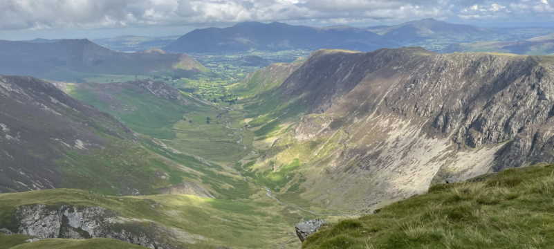
Tay Bridge from above the Carse
I was now back on a familiar road I travelled down before and knew I’d soon be whizzing down the Braes towards Inchture, passing through the village I decided to have a look at the sandstone church. Another church?. Ah, but this one has family connections, Katie’s grandfather was the minister circa the 1930s.
The Carse and back to base, this time the wind was at my back so I made a good time and soon was heading up out of Kingoodie towards Invergowrie.
Three cracking days, except the damp parts of Monday’s trip. Over 115 miles rode.
Thanks to all sites I have linked to.
To embiggen any image, just click for a larger image.


