My impulsiveness shows no ending when I leave out on my bike. I check the weather before I head to get prepared. Uphill or downhill? I decide a rough route after the first rise as I see what my legs are saying. I come to a junction and at 50% of the time, I just choose what way. I have been known to preplan something but rarely. I see a side road, where does that lane go to? Plenty of time to explore.
This run was no different, I’d left mid morning a little later than normal and stopped to chat with old workmates. I’d mentally made a thought of heading up, over and back over the Erskine Bridge.
10 miles later, I was topping the bridge and as I swung under to return, I just dropped down Lusset Glen. A quick left, right and I was on Route 7 and heading west alongside the canal and its boat harbour and up over on to the track built on the old Lanarkshire and Dumbarton railway. I decided as I was later out than normal, I’d drop into a nearby service station for some lunch but it was busy. I thought there must be somewhere else (it turned out to Roseneath).
I headed towards Bonhill where I’d drop down and join the track which runs alongside the River Leven, yes, the last and other posts have this run. Soon I was in Balloch, I keep missing the path but after a quick run through the Shores car park, I was soon passing through Duck Bay, I saw two portable barbeques being used and the skewers on one looked inviting.
The Arden roundabout was crossed and next to the B831 to Helensburgh, there is an excellent cycle path which runs to above Helensburgh but today, I’d head off into Glen Fruin at the Crosskeys roundabout.
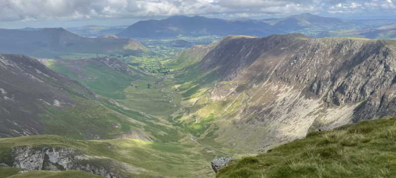
I was soon pedalling up, and up until finally, I could see the glen ahead. I have been along the newer Haul Rd which runs parallel just a few hundred yards to the north with its rollercoaster of hills and dips. It was done on a June ’14 day but WX was much different, I’d suffered from the sun and heat that day and as I dropped down the first hill today, the rain came on, heavy.
A stop at the bottom and a throw on of a waterproof top but in usual sod’s law, the rain stopped. I could see activity on the road ahead and I got waved through by the local estate shepherds who were ready move a flock to the west side of the glen.
I could see work taking place on the new John Muir Way path which comes over from Helensburgh and runs along the Fruin hillside. I could see the route up Auchengaich Hill and a figure in red jacket moving down, I assume coming from Beinn Chaorach.
I could see the road slowly rising out of the glen and a quick drop before the slog upwards, I came across a sign which told me ‘troops may be training, expect loud explosions or illumination’, I did try to see if the red flag was flying on the nearby Strone (the ridge up Beinn a’Mhanaich) which indicates if training is taking place but low cloud masked any view.
The road surface was far better than I’d expected, a smooth surface and a joy to plod on even the hills which I’d really meet as I exited the glen, finally at the top, I’d the choice of dropping down or taking a short MOD blocked road.
The short cut it was although looking back I should have taken the direct road, next time! I just wanted to whizz quickly downhill into Garelochhead. The main road was strangely quiet and I passed Faslane Naval Base then into the village where I took the road to down the Gareloch towards Kilcreggan and my intended ferry trip back to Gourock on the south bank of the Clyde. The road along the loch was busy as I neared Clynder, a rumbling tum and a lack of food meant the next food stop I was filling up. I spot a sign for Polly’s Cafe but as I passed, it was closed. I cycled up into Roseneath, I saw a Co-op, I parked up and headed in, a BLT sandwich and a can of Irn Bru.
I sat on a nearby church dyke, enjoying the sandwich and drink and thought not long until the pier. I forgot how steep a rise was between the villages but I soon topped and freewheeled to the pierhead. I’d 30 mins until the ferry left. I sat and enjoyed the view.
Kilcreggan hasn’t really changed much since I spent my ‘holidays’ with my dad in an old canvas tent, a couple of old army blankets and my days spent on the beach fishing with a handline, gathering whelks and mussels for a ‘boiling’, aye, good easy living. We’d spend a fortnight (or near enough) unless the weather really got bad.
Soon the ferry arrived at Gourock Pier and it was 7 miles until home, I cycled towards where Route 75 would start to go uphill but instead of following the recommend route, a detour cut out some of the steep stuff and soon it was the track to almost home.
53 miles in the log and a great day out (they all are).
I’ll certainly redo this outing.
I’m really peeved at missing the stone commemorating the Battle which took place in Glen Fruin at the west end just before you rise out of the Glen, an excuse to return, eh?
I’ll link to HERE HERE for further info on the battle.
My thanks to Wikipedia and other websites linked to.
Click on any image to embiggen.


